Monsoon 2021- A Series of Extreme Weather Events
Representational use only.
The Monsoon season in 2021 has been a roller coaster ride. Weather models went haywire, making it the most pulsating season so far. While both the onset and withdrawal months made thumping beginning and end respectively, core monsoon months of July and August, failed miserably. This unpredictability is making weather forecasting an increasing challenge and meteorologists believe that it will continue to be so amidst changing weather dynamics. It would not be wrong to term Monsoon 2021 as the season of extremes. Right from extremely deficient rainfall to extremely surplus rainfall was witnessed across the country. The deficit rainfall pockets such as West Madhya Pradesh, East Rajasthan, and the Marathwada and Vidarbha regions of Maharashtra are all surplus, while the rainiest pockets like Kerala, Odisha and north-eastern pockets of the country struggled to meet their average rainfall quota.
According to an analysis by the Council for Energy, Environment and Water (CEEW), more than 75% of Indian districts are exposed to extreme climate events. Subsequently, over 40% have experienced climatic disruptions such as a shift from being flood-prone to being drought-prone, or vice-versa. Southwest Monsoon 2021 has come to an end with normal rainfall to the tune of 99% of the long period average (LPA). However, rainfall distribution has been completely erratic. This pattern has once again reaffirmed the climate change impact on Indian Summer Monsoon rainfall.
“Extreme weather events are the clear cut result of climate change. Frequency of heavy rainy days during the Monsoon has increased and the frequency of light rainy days have decreased,” said Mrutyunjay Mohapatra, Director General of Meteorology, India Meteorological Department.
Monthly Monsoon Performance
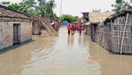
The onset of monsoon in the month of June made a thumping start around the near normal date. The progress as well as performance of Monsoon 2021 was steady through the initial two phases of the Southern Peninsula and East & Northeast India. However, Monsoon stalled thereafter just before entering the third phase of Northwest India. The month ended with surplus rainfall to the tune of 110% of LPA. The dry spell consumed the surplus of June during the last week itself. July started on a deficit note and the first 10 days of the month saw the performance of Monsoon deteriorating further. As of July 11, the countrywide rainfall was deficit by 8%. Although last week saw some revival, the month ended with a deficit of 93%. July however, saw a continuous spell of heavy rainfall for two-three days which ended up flooding the affected regions causing damage to the property and human lives. Floods, landslides and other calamities due to torrential rains claimed 125 lives in India. Mahrarashtra was the worst hit in July in four decades. Environmentalists have been warning against indiscriminate development, choking drainage sites , blocking water reservoirs and tempering with the riverine system.
With 24% deficit rainfall, August made history for the worst performance of Monsoon. While it has been the sixth driest August since 1901, it is the first since 2009 which was a drought year, courtesy El Nino. The reason can be attributed to absence of the Monsoon weather systems, which then kept the Monsoon trough north of its normal position, bringing torrential rains across the hilly states of Himachal Pradesh, Uttarakhand and foothills of Himalayas like East Uttar Pradesh and Bihar.
Failure of core Monsoon months
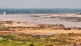
The country recorded normal Monsoon rains to the tune of 99%. However, the core Monsoon months of July and August failed to perform. Farmers in the country, especially small and marginal sections , have been suffering crop loss due to less rainfall and drought-like situation. The crop yield gets affected if they don’t get the required amount of water at a certain period of cultivation.
Meteorologists have attributed this to the absence of Monsoon low pressure areas that account for 60 per cent of the seasonal total rainfall. But, what is the reason behind these missing low pressure areas? “The erratic evolution of the monsoon through July and August can be attributed to the little brother of the El Niño from the Atlantic. Atlantic Niño’s impact on the monsoon was established in 2014 when an INCOIS led study showed that the number of low-pressure systems is sharply reduced by the Atlantic Niño, leading to deficit monsoons. This season, the sea-surface temperatures over the tropical eastern Atlantic were warmer than normal. The strongest Atlantic Niño event of the past 40 years occurred during June-August. We can blame the significantly fewer low-pressure systems in 2021 on the Atlantic Niño. Monsoon 2021 is a clear example of this missed link,” said Professor Raghu Murtugudde, Earth System Scientist at The University of Maryland's College of Computer, Mathematical, and Natural Sciences (Atmospheric & Oceanic Science)
More rains and more dry days
The country might have had the desired amount of normal rainfall but it is far away from being a normal one. The rainfall distribution has gone for a toss as we now see the majority of rainfall in just a few days. “Monsoon 2021 has recorded 874.6 mm against the normal of 880.6 mm. With this, we can say that rains are more but rainy days are still less. There are large gaps between the rainy spells, increasing the dry spells,” said Mahesh Palawat, vice president Meteorology and Climate Change, Skymet Weather.
He added “The frequency of drought periods has increased in the last 10-15 years. We need to seek out adaptation measures such as creating water storing facilities and recharge the groundwater table using technological solutions”
Withdrawal of Monsoon strikes a hattrick
Southwest Monsoon 2021 has defied the official withdrawal date and is unlikely to commence anytime soon before October 6-7. With this, it is all set to score a hat trick in the delayed retreat of the Monsoon season after 2019 and 2020. While 2020 saw the process of withdrawal of Monsoon commencing on September 28, it was 2019 which started bidding farewell to Monsoon rains on October 9, making it the most delayed retreat of the monsoon since 1975. As reiterated above, atmospheric conditions kept the Monsoon current active. The Indian Ocean Dipole and La Nina could be given special mention for letting Monsoon leave the country. “La Nina has a strong relation with the wetter Monsoon and evolving it may lead to delayed withdrawal of the Monsoon. This is what has been seen this season. A transition from Neutral to La Nina is likely during the winter of 2021-22. In mid-September, sea surface temperatures (SSTs) in the east-central Pacific are about -0.4°C different from the average. Key atmospheric variables are in consonance with neutral conditions. A La Nina watch is ‘on’ for September 2021,” said GP Sharma, President- Meteorology and Climate Change, Skymet Weather...
Earlier, the stipulated withdrawal from extreme West Rajasthan was September 01. However, looking at the changing weather patterns during 1971-2019, this was revised last year and the new date has been fixed at September 17. Withdrawal dates have been shifted by 7-14 days across most parts of the country including the national capital, where the new date is taken as September 25. “Unlike onset, we do not have set criteria for the withdrawal of Monsoon but we need to have a visible change in the atmospheric conditions before the announcement of retreat. The rains over the region, by and large, have ceased, followed by the reversal of wind patterns to drier north-westerly. Secondly, a drop in the humidity along with mostly sunny days has become a norm. Rise in the day temperature at least for a week or two, nearly coincides with the 2nd summer for the region,” added Sharma.
Cyclone Gulab, third cyclone in Bay of Bay Bengal of the century in September
Cyclone Gulab,the third cyclone in Bay of Bay Bengal of the century in September Another rare event during the Monsoon 2021 is the formation of a tropical storm in September. Cyclone Gulab had formed in the Bay of Bengal and made landfall near Srikakulam over North Coastal Andhra Pradesh around midnight on September 26. Gulab is the third cyclone of this century to form in September after Cyclone Daye hitting Odisha near Gopalpur on September 21, 2018 and Cyclone Pyaar on September 19, 2005. The post monsoon Cyclone season spans from October to December for the Indian Seas, both the Bay of Bengal and the Arabian Sea. Accordingly, very few storms form in September, the fag end of the southwest monsoon season as the Monsoon current is very strong and vertical wind shear is very high. Moreover, striking the Andhra Pradesh coastline is further rare, as the storms normally head for the Odisha coast during this time.
Get the latest reports & analysis with people's perspective on Protests, movements & deep analytical videos, discussions of the current affairs in your Telegram app. Subscribe to NewsClick's Telegram channel & get Real-Time updates on stories, as they get published on our website.


